
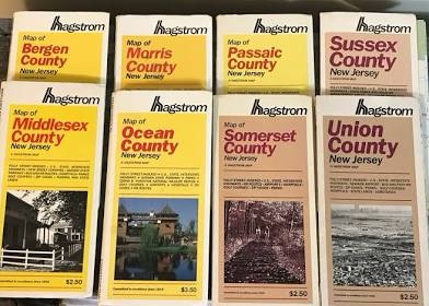
Like everyone else I know, we use the GPS on our phones to navigate when we travel. During the first half of our career, though, we used maps made by Hagstrom. We owned several map books for New York and New Jersey counties and another one or two for Connecticut and Massachusetts.
When we needed to travel, I would pull out the appropriate book the night before a journey and pick a route to get us there. Typically, I would create an index card and save it in case we returned to that location in future years.
As you might guess, it’s a lot easier to plug an address into an app on our phones and receive turn by turn directions in a minute or two. Today’s GPS’s also monitor traffic congestion and present updates to routes when a satellite spots a problem.
All of that said, I miss the days of maps for a couple of reasons. First, it was fun to plan a route. It was a kind of puzzle. Second, I really learned the basic layout of the areas where we traveled. Often, I did not need a map because I knew where places were and how to get there based on the internal maps in my head.
As AI and other technologies improve, life will get easier. The question is: will it get better?